TomTom traffic index
About
Featuring more than 500 cities across 62 countries, the 14th edition of the TomTom Traffic Index is our most robust and complete analysis ever. The Index ranks these cities based on their average travel time, as well as congestion; providing access to traffic information city-by-city. TomTom Traffic Index insights helps drivers, pedestrians, city planners, carmakers and policymakers tackle traffic challenges and make informed decisions for a better tomorrow.
Our methodology
The TomTom Traffic Index is based on floating car data (FCD). TomTom collects this data from various sources to create traffic services for our clients and customers. In the Traffic Index, we use a representative sample of this data, spanning 737 billion km, to assess and show how traffic evolved in cities around the globe throughout 2024.
The travel time in each city is a result of multiple factors which can be grouped into: A) quasi-static factors (e.g., road infrastructure, such as street categories, road sizes and capacities, or speed limits) or B) dynamic factors that influence traffic flow (e.g., traffic congestion, roadworks, bad weather, etc.). The static factors determine the optimal travel time in a city (as shown on the city pages), whereas the dynamic factors provide a basis to interpret traffic flow changes – the sum of both gives us the travel time.
New definition of city and metropolitan area
This year, we have updated our methodology for defining city centers and metropolitan areas. The objective is to more accurately reflect actual traffic conditions and facilitate standardized comparisons across different cities. The foundation of the new definitions is rooted in TomTom’s Origin-Destination (O/D) Analysis, which provides detailed insights into the volume of trips between geographical areas.
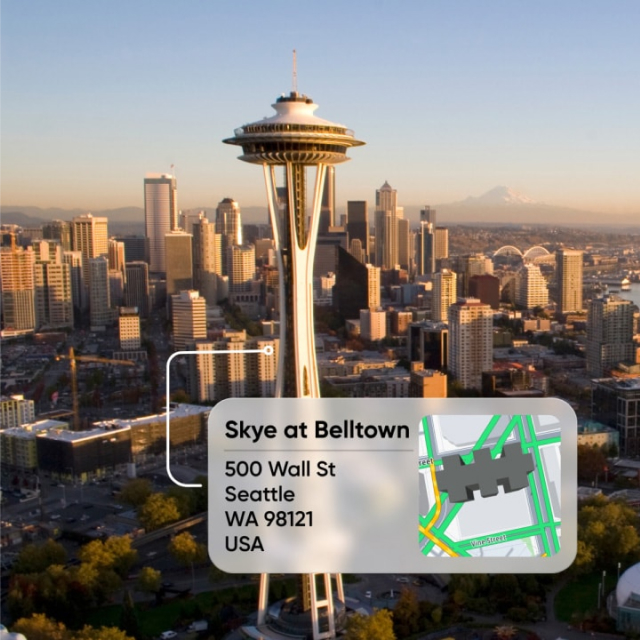
How is a city defined?
We leverage anonymized vehicle movement data to examine traffic flows within a metropolitan region. This area is overlaid with a comprehensive hexagonal grid covering 4,300 square kilometers, where each hexagon cell represents approximately 4.5 square kilometers.
We extract movement patterns between all hexagons in the form of an O/D matrix using the TomTom O/D API. This data aids in identifying city-connected areas, which are clusters of regions (hexagon cells) exhibiting significant traffic flow between them. High traffic flow among these regions indicates strong socio-economic ties.
City centers are defined by selecting the densest areas that capture 20% of all trips within the city-connected area.
Metropolitan areas encompass the trip-dense regions that account for 80% of all trips within the city-connected areas.
The selection process is carried out systematically by adding regions with the highest traffic intensity until the specified thresholds (20% for city centers and 80% for metropolitan areas) are reached.
Why this approach?
Utilizing TomTom's global Floating Car Data (FCD) coverage, we have developed a traffic-based framework for defining city centers and metropolitan areas. This method standardizes our definitions, ensuring they reflect actual movement patterns of real people and maintain consistent logic across cities worldwide.
How is the congestion level calculated?
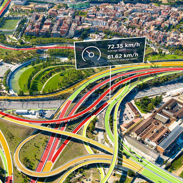
Congestion is calculated by collecting all the travel times recorded by TomTom during a given period of time in a given area and comparing them with the lowest travel times from when traffic is in a totally fluid state. Congestion is expressed as a percentage, which is representative of the increase in travel time due to excess traffic. For example, a congestion level of 40 mean that, on average, journey times across that area's road network were 40% greater than when traffic is free-flowing.
Why doesn't the most congested city also have the slowest average speed?
The congestion level of a city is based on the dynamic factors that affect its traffic flow. As explained above, congestion is recognized as the difference between free-flow or optimal traffic conditions and actual travel time. Free-flow travel times are based on static factors in each city, making the score relevant to that city's infrastructure and environment. It does not take the same time to drive 10 km without traffic in Amsterdam, the Netherlands as it does in New York, U.S.A. as they both have different speed limits, road layouts and infrastructure.
New for this year: Vehicle Volumes
This year we have added vehicle/traffic volume insights for U.S. cities. TomTom specializes in Floating Car Data (FCD, vehicle probe data). We observe and gather data from up to 1 in 4 vehicles on European and North American roads in daylight hours. Data is collected from four key sources: connected cars, mobile navigation applications, on-dashboard navigation devices (satnavs) and managed fleet telematics devices (blackboxes). This provides the basis for our live and historic traffic speed estimations and is a powerful tool for making a precise estimate of total traffic volumes.
Definitions
- Travel time for one kilometer
- This is the total travel time (sum of all traversals) divided by the total km driven (sum over all traversals), a traversal refers to an observed vehicle traveling over a road segment. The travel time and km-driven are calculated for each directed road segment (DSEG) within the city area (s.a.) on an hourly basis. We then sum overall DSEG times and km-driven and divide the total travel time by the total km driven.
- Congestion level
- Increase in travel time due to excess traffic. For example, a congestion level of 40 mean that, on average, journey times across that area's road network were 40% greater than when traffic is free-flowing.
- Total distance driven
- Based on TomTom’s Historic Traffic Volumes product estimates, at road segment level, the Annual Average Daily Traffic (AADT) value. Currently available for U.S. cities.
- Time lost in traffic
- The time difference between the same trip in optimal conditions (free-flow travel times) and the current travel times including congestion.
- Time lost per year
- The average time lost as a result of being stuck in traffic over the course of a year. We assume 230 working days a year, therefore 230 trips per year, a trip is considered an entire day's travel to and from a destination.
- Time in rush hour per day
- This is calculated as the total sum of travel time of a round trip, including during the morning rush hour (to) and the evening rush hour (from). In this instance we use the most common commuting time.
- Time in rush hour per year
- This is the time lost to rush hour commutes across the entire year. 230 working days equates to 230 round trips per year.
- Morning/evening rush
- Based on traffic flow measurements, we calculate the busiest parts, morning and evening, of each day in each city.
- Weekly driving patterns by time of day
- This table, on each city page, shows how driving times fluctuate based on the time of day as a weighted average over the whole year, for each hour of the day. The weighted average is based on distance driven, so a road that is busier has a higher weighting. This reflects how most drivers experience traffic.
- Live travel time per 10km (6mi)
- The live (real-time) measure of traffic in each city. This shows the average time it would currently take to travel 10 km or 6 miles. It's calculated using TomTmo's real-time traffic information, as opposed to historical data, which is based on a sample of 2024 data. We use the live Traffic Flow feed and our Speed Profile products, which are not limited to historic 2024 data.
- Usual travel time
- Typical travel time per 10 km (6 mi) based on TomTom historic speed profiles.
- Live traffic jams
- The current number of traffic jams and their total length, based on TomTom's real-time traffic information.

Traffic Analytics
TomTom Move
Get the insights you need to manage traffic, improve mobility and make location-informed decisions.
Smarter Cities
Public Sector & Governments
Enhance citizen safety or support sustainable urban growth, TomTom empowers governments to make smarter, data-driven decisions while maintaining privacy.

Analyse intersections
Junction Analytics
TomTom Junction Analytics helps road authorities, traffic managers and engineers monitor and improve traffic light performance, making roads safer, greener and less congested.
Find bottlenecks
Traffic Stats
With years of data on road speeds, travel times and traffic density, TomTom Traffic Stats give you the insights you need to understand, predict and reduce congestion.
Calling all city planners, automakers and policy makers – let’s change the way the world moves.
Contact usCopyright
You are permitted to use the contents of www.tomtom.com/traffic-index in online, offline and social media and other publication channels for non-commercial purposes with clear reference to TomTom International BV as its main source. You are not permitted to modify, compile, adapt or use any part of this website in any way for commercial purposes without a written agreement from TomTom International BV.